What Your Dream Dock House Actually Costs: Decoding Flood Zones, Elevation Certificates, and the Real Price of Waterfront
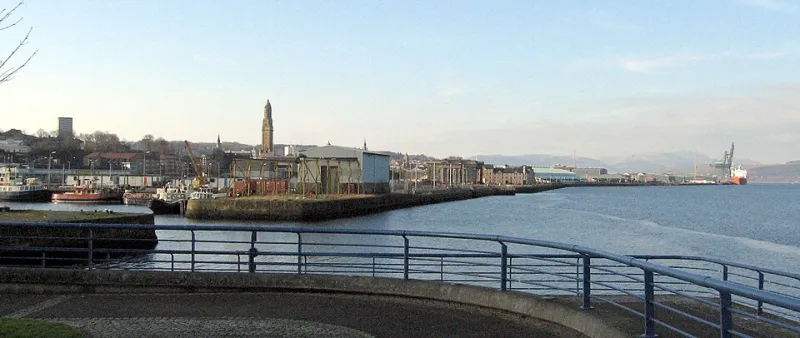
Photo: No machine-readable author provided. Dave souza assumed (based on copyright claims)., CC BY-SA 2.5, via Wikimedia Commons
The Sticker Price Is Only the Beginning
Every waterfront buyer remembers the moment. The porch, the water glinting past the rail, the osprey circling the channel. What nobody remembers is the flood zone letter — and that's exactly the problem. On the harbor, the number that decides whether a home is affordable isn't the one on the listing sheet. It's the one buried in a FEMA map and an insurance quote.
We've watched buyers stretch to reach a price point, then get blindsided when their escrow jumps by $800 a month. It doesn't have to be that way. Here's the paperwork that quietly sets your waterfront budget, and how to read it like a local.
Start With the Map, Not the Listing
FEMA's Flood Insurance Rate Maps (FIRMs) divide every coastal parcel into zones, and the letters matter:
- Zone V (Velocity): The most exposed coastal areas — expect wave action, the strictest building codes, and the steepest premiums.
- Zone AE: High-risk areas subject to base flood elevations (BFEs). Common in harbor-adjacent neighborhoods.
- Zone X (shaded or unshaded): Moderate-to-low risk. Cheaper insurance, but don't assume zero risk — plenty of flood claims come from "low-risk" zones.
Maps are also redrawn. A home mapped as Zone X a decade ago can land in Zone AE after a coastal study, and with it comes a mandatory insurance requirement if you're financing. Before you make an offer, check the map date and ask whether the community has a map revision pending.
The Elevation Certificate Is Your Best Friend
If the flood map tells you the risk, the elevation certificate tells you your fate. This document — usually prepared by a surveyor — records exactly how high the home sits relative to the Base Flood Elevation.
The math is simple: the higher above BFE, the lower the premium. A house elevated on pilings three feet above BFE might insure for a fraction of a similar slab-on-grade home next door. Two homes on the same street, same square footage, can carry wildly different insurance bills purely because of how they sit on their lots.
If the seller doesn't have a certificate, ask for one. A few hundred dollars for a survey can save you thousands per year — and it arms you with leverage at the negotiating table.
Insurance: The Line Item That Doubles Payments
National Flood Insurance Program (NFIP) policies cap out around $250,000 in structure coverage, which is why many harbor homes also carry excess flood coverage and a separate wind/hail policy — especially in hurricane country. Add it up, and waterfront insurance can run anywhere from $1,500 to $10,000+ annually depending on zone, elevation, and construction.
A few levers that move the number:
- Elevation and foundation type (pilings and elevated mechanicals win)
- Roof shape and age (hip roofs fare better than gables)
- Community CRS rating — towns that invest in flood mitigation earn residents premium discounts, sometimes up to 25%
- V-zone construction details like breakaway walls
Always get an insurance quote before the inspection period ends. A good coastal agent can arrange one in days.
Three Buyers, Three Budgets
Buyer 1 — The $350,000 Cottage (Zone AE, near BFE): Mortgage on a $280,000 loan runs roughly $1,900/month at current rates. Add NFIP flood ($2,400/year), wind coverage ($1,800/year), and standard homeowners (~$1,400/year). That's about $460/month in insurance, pushing the real payment to $2,360. Manageable — if you budgeted for it.
Buyer 2 — The $750,000 Harbor Home (Zone AE, elevated on pilings): A $600,000 loan means ~$4,000/month principal and interest. But elevation pays off: flood runs ~$1,200/year, wind ~$2,500/year, homeowners ~$2,800/year — roughly $540/month in insurance. The premium home is cheaper to protect than the cheap one, relative to price.
Buyer 3 — The $1.2M Waterfront Showpiece (Zone V): An $960,000 loan means ~$6,400/month P&I. V-zone construction means higher wind premiums and excess flood coverage beyond NFIP limits: call it $1,100–1,400/month all-in. Total carrying cost approaches $7,800/month. Doable for the right buyer — but only if they modeled it from day one.
Your Pre-Offer Checklist
- Pull the FEMA FIRM panel and note the zone and map date.
- Request the elevation certificate — or budget for a new survey.
- Get an actual insurance quote, not an estimate from a friend.
- Ask about the community's CRS rating and any pending map revisions.
- Check elevation of mechanicals, electrical, and the HVAC.
The water isn't going anywhere, and neither are the rules that come with it. Read the fine print first, and the harbor view will feel a whole lot sweeter when you know exactly what it costs to keep it.